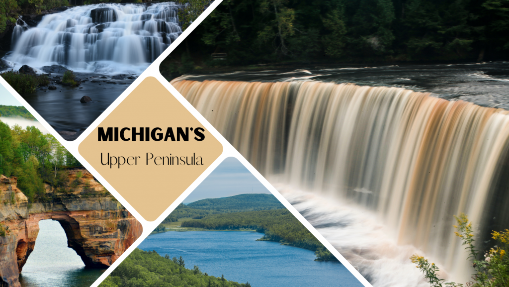
Michigan’s Upper Peninsula is a waterfall lover’s paradise. With over 300 cascading waterfalls, there are plenty of opportunities to get your heart racing and your camera clicking. The best part? Most of these waterfalls are located in state parks and forests, so they’re easy to access.
Below are a few of my favorite waterfall hikes in the Upper Peninsula that should be on everyone’s summer road trip list!
Cascade Falls
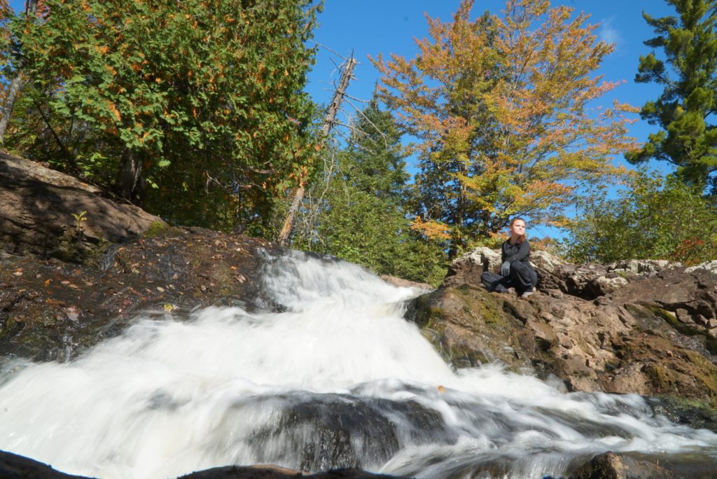
Cascade Falls is a beautiful and secluded waterfall for the adventurous, located just outside of the Porcupine Mountains Wilderness State Park. The hike will make you feel off the grid. The trail to the falls is about a 2-mile (3.2km) round trip, and it’s a moderate hike with some steep sections.
Here’s my suggestion for the best way to hike Cascade Falls:
- Start by taking the trail clockwise. The beginning is pretty steep, but it’s worth it for the stunning views of the falls from the top.
- Once you reach the lookout point, take a few minutes to catch your breath and admire the view. Then, continue on the trail to the bottom of the falls.
- The trail to the bottom is a bit steep and challenging, but getting up close and personal with the falls is well worth it.
For those looking to avoid the steep climb, take the loop counterclockwise and hike an Out & Back route. You will reach the waterfall on relatively flatter terrain.
Distance: 2.0 Miles (3.2km)
Route Type: Loop Trail
Elevation Gain: 318 Feet (96m)
Difficulty: Moderate
Sable Falls
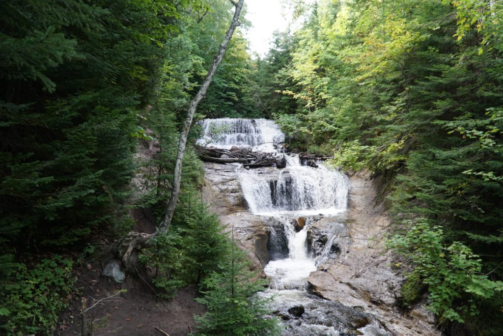
Sable Falls is a beautiful and picturesque hike that takes you on a path that follows the stream to Lake Superior. The falls are stunning as they cascade down over a series of rocks, surrounded by lush greenery. As you venture out towards the lake, you can cross a small stream and relax on the beach. The beach is awash in various stacked stones and the start of the dunes.
Here’s what you can expect on your hike:
- A scenic trail: The trail to Sable Falls is well-maintained and easy to follow. It winds through the woods, along the stream, and eventually to the lake.
- A beautiful waterfall: Sable Falls is a sight to behold. The water cascades down over a series of rocks, creating a stunning waterfall.
- A peaceful beach: Sable Falls is a great place to relax and enjoy the scenery. You can swim in Lake Superior, build sandcastles, relax on the beach, and soak up the sun.
- A unique landscape: The dunes at Sable Falls are a unique landscape. They are constantly shifting and changing, creating a continually evolving landscape.
Distance: 0.5 Miles (0.8km)
Route Type: Out and Back
Elevation Gain: 95 Feet (29m)
Difficulty: Easy
Hurricane River to Log Slide
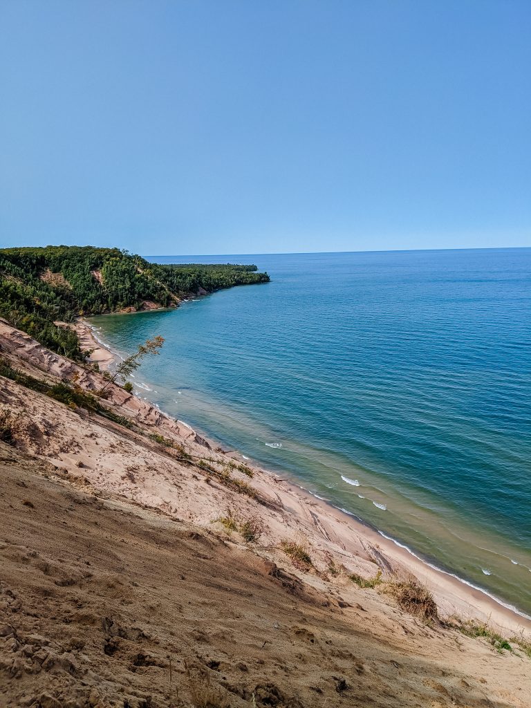
Begin your 7.6-mile (12.2km) hike along the shores of Lake Superior, where you can enjoy stunning views of the lake and its rock formations. As you hike, you will pass by a lighthouse, which is a great place to stop and take photos, and more scenic spots along the way! Venture into the woods of towering pines and maples, where the beauty of nature will surround you. Watch for wildlife, such as deer, bears, and birds, and keep a safe distance if you encounter any on the trails!
Once you reach the end of the trail at Log Slide, you can go down to the edge of the dunes to take in the breathtaking view of the lake and lighthouse. This is the perfect time to grab a snack before heading back!
This hike is a great way to experience the beauty of the Upper Peninsula. It is also a great way to get some exercise and fresh air.
Distance: 7.6 Miles (12.2km)
Route Type: Out and Back
Elevation Gain: 413 Feet (125m)
Difficulty: Moderate
Miners Falls
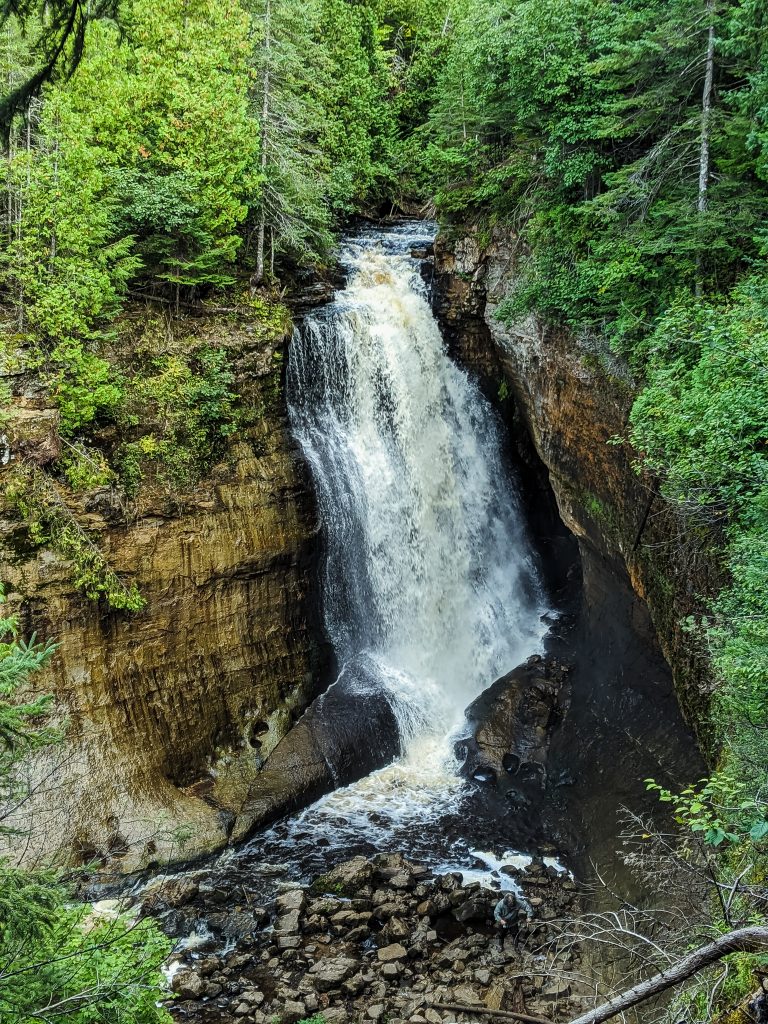
Miners Falls is a top-rated hiking destination in the Upper Peninsula of Michigan. The area has several trails varying in difficulty that offer stunning views of Lake Superior, the Pictured Rocks National Shoreline, and Miner Castle.
Let’s explore the top three trails in the area!
Miners Falls Trail
The Miners Falls Trail is a 1.2-mile (1.9km) out-and-back trail that takes you to the base of the falls. The path is easy to moderate and is perfect for families and hikers of all levels.
Miners Falls Beach Loop Trail
The Miners Falls Beach Loop Trail is a 2.4-mile (3.9km) loop trail that takes you to Lake Superior. The moderate trail offers stunning views of the Pictured Rocks National Shoreline and is perfect for spending time on the beach.
Miners Castle Trail
The Miners Castle Trail is a 3.2-mile (5.1km) out-and-back trail that takes you to Miner Castle. The moderate trail offers stunning views of the Pictured Rocks National Shoreline and Lake Superior. The Castle Rock formation is blocked off, but you can still capture beautiful photos of the rock formation and the shoreline below.
No matter your experience level, you’ll find a trail perfect for you at Miners Falls. So lace up your hiking boots and explore this beautiful area!
Distance: 1.2-mile (1.9km) for Miner Falls; 2.4-mile (3.9km) for Miners Falls Beach Loop; 3.2-mile (5.1km) for Miners Castle
Route Type: Loop and Out and Back (depending on the trail)
Elevation Gain: 141 Feet (125m)
Difficulty: Easy
Chapel Beach Loop
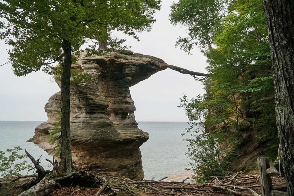
Chapel Beach Loop trail is everything you would want to see while hiking in the Upper Peninsula. The path starts with a leisurely walk through a beautiful forest floor, where you will cross several streams and feast your eyes on Chapel Falls. As you continue your journey, you will begin to see Chapel Rock, a picturesque rock formation off the shoreline of Lake Superior. Be sure to descend to the beach area and make your way across the shoreline to check out more of the sandstone terraces and the stunning rock cliff walls.
Pro-tip: Arrive early to grab a parking spot and drive slowly down the dirt road, the road can be filled with many deep potholes.
Distance: 6.5 Miles (10.4km)
Route Type: Loop Trail
Elevation Gain: 390 Feet (119m)
Difficulty: Moderate
Black River to Rainbow Falls
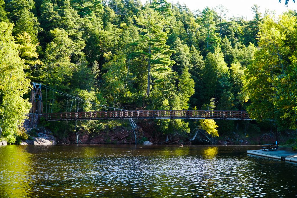
Prepare to climb some stairs on this hike! The trail starts with a suspension bridge that leads you directly to a long flight of stairs. Once you reach the top, the path is peaceful as it winds through the woods. We were lucky to have the trail to ourselves. There are some great photo opportunities for the beautiful falls. You can also get up close and personal with the falls by taking the path. However, be careful when walking to the edge. The rock beds next to the waterfall are slippery, and a steep gorge is below.
Pro-Tip: Take the trail instead of the overlook. You will be able to experience a lot more and get some great photos of the waterfall.
Distance: 1.3 Miles (2.1km)
Route Type: Out and Back
Elevation Gain: 190 Feet (58m)
Difficulty: Easy
Lake of the Clouds
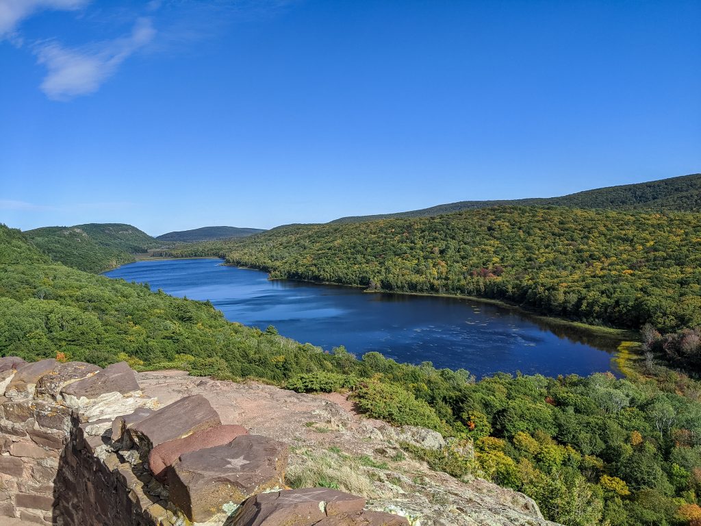
Stop at Lake of the Clouds if you’re hiking in the Porcupine Mountains. The overlook is picturesque, with the lake nestled between two mountain ridges. On a clear day, you can see for miles in every direction. The lookout can be uneven and steep in some areas, but the trail to the overlook is easily accessible.
If you’re feeling energetic, you can hike down to the lake. The path to the lake is more challenging as it winds through wetlands and over rocks. But the hike is definitely worth getting another perspective of the lake.
Pro-tip: Arrive early morning or evening to avoid crowds and get those fantastic photos of the stunning lake.
Distance: 1.4 Miles (2.3km)
Route Type: Out and Back
Elevation Gain: 334 Feet (102m)
Difficulty: Easy
Presque Isle Falls Loop
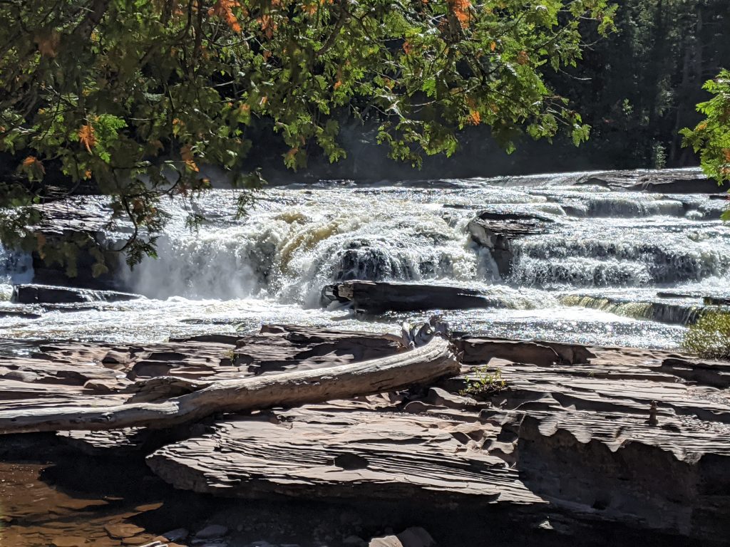
Looking for a hike that’s packed with nonstop waterfalls? Look no further than the Presque Isle Falls Loop! This scenic trail takes you past three different waterfalls, including the towering Manabezho Falls, before finishing on the shores of Lake Superior.
The trail is a mix of boardwalks and dirt paths, making it easy to navigate for all levels of hikers. You’ll hike through forests, over rivers, and past waterfalls, all while taking in the stunning views of the Porcupine Mountains.
The entire loop is less than an hour long, but take your time and enjoy the scenery. There’s nothing quite like the sound of rushing water to create a sense of peace and tranquility.
So what are you waiting for? Lace up your hiking boots and hit the trail!
Pro-tip: Be sure to download All Trials, this will help keep track of which hiking trail you’re on to avoid confusion.
Distance: 1.6 Miles (2.6km)
Route Type: Loop
Elevation Gain: 157 Feet (48m)
Difficulty: Moderate
Bond Falls Loop
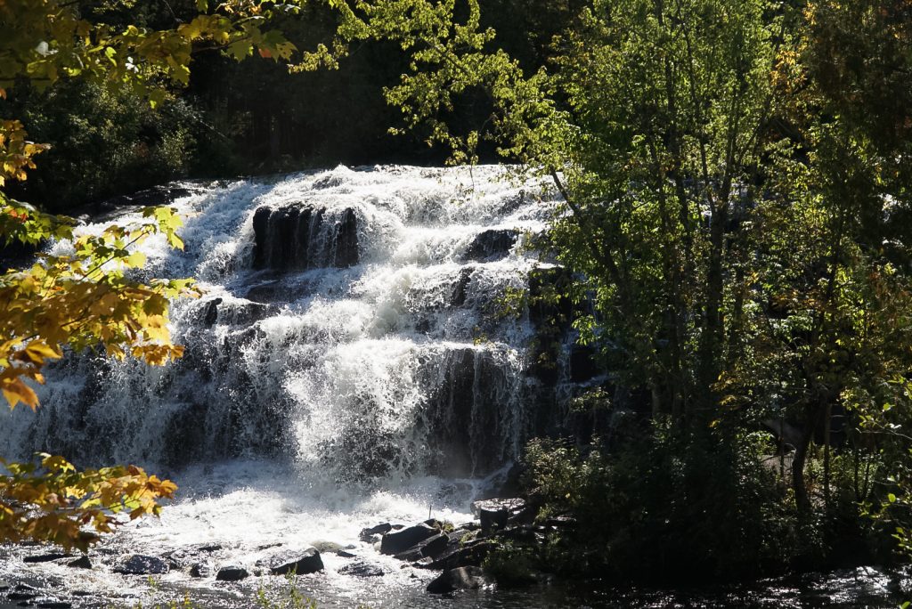
Bond Falls elevates waterfalls to the next level by cascading 50 feet (15m) below in a series of fractured rock pieces. The multiple small cascades leave many people awe-inspired. Most people venture to the falls and turn around after. I suggest taking the loop trail that goes around the falls.
The loop trail is a short and easy hike offering stunning views of the falls from different angles. You’ll be able to see the falls from the top, the bottom, and even from behind. You’ll also be able to spot even more rushing rapids throughout the journey.
Don’t miss your chance to take in the entire area. Bond Falls is one of my favorite waterfalls due to its vastness.
Pro-tip: Make sure to hike the full loop trail that ventures around the waterfall. You will be surprised to find a few more little waterfalls along the way! Also, be mindful of taking it easy coming down on the stairs. The mist from the falls makes the steps slippery.
Distance: 0.9 Miles (1.4km)
Route Type: Loop
Elevation Gain: 137 Feet (42m)
Difficulty: Easy
O Kun-de-Kun Falls
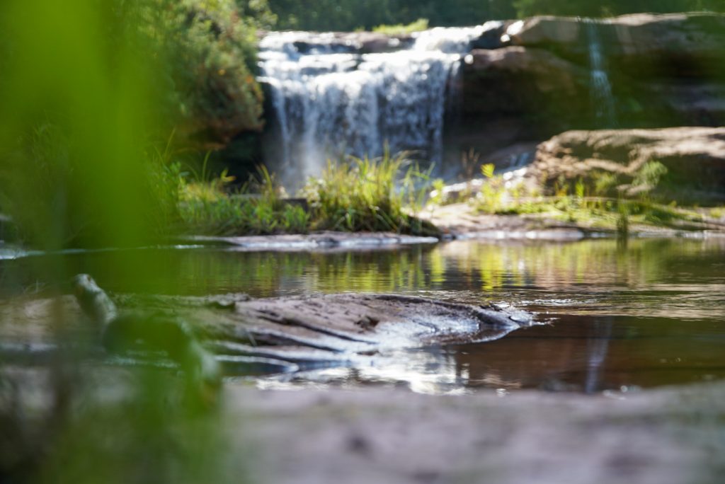
O Kun-de-Kun Falls is a hidden gem near Porcupine Mountains. This beautiful plunging waterfall is less-traveled than some other trails in the area, but it is well worth the hike. The trail is about 1.5 miles (2.4km) long and moderately complex, but the views of the falls are worth it.
O Kun-de-Kun Falls is unique because you can walk behind the falls with low water. This is a truly unique experience that you won’t find anywhere else. The falls are about 30 feet (9.1m) tall and 25 feet (7.6m) wide and the water flows down a steep sandstone ledge. The spray from the falls can be refreshing on a hot day, and the sound of the water is very calming.
If you are looking for a challenging hike with a unique reward, O Kun-de-Kun Falls is the perfect place. Be sure to bring your camera, as you will want to take advantage of the opportunity to capture this fantastic waterfall in a remote area of the Upper Peninsula.
Pro-tip: If you venture behind the waterfall, make sure to wear waterproof shoes with good grips.
Distance: 2.7 Miles (4.3km)
Route Type: Loop
Elevation Gain: 154 Feet (47m)
Difficulty: Easy
Tahquamenon Falls
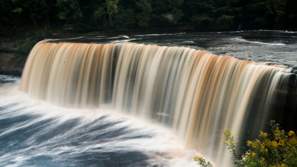
Tahquamenon Falls is one of the most iconic and unforgettable waterfall series in the Upper Peninsula of Michigan. The Lower Falls are well-known, with easy access for viewing. The Upper Falls are even more impressive, with a drop of 50 feet (15m). Take the time to hike from the Lower Falls to the Upper. It’s worth it!
The hike to the Upper Falls is generally an easy to moderate paved trail that takes you on a beautiful hike with several lookout spots. Along the way, you’ll be treated to stunning views of the Lower Falls and the surrounding forest.
Once you reach the Upper Falls, be blown away by their sheer size and power. The falls are so loud that you can feel the vibrations in your chest. And the milky white water is simply mesmerizing.
For years, the only way to get up close and personal to Lower Falls Island was by renting a boat and rowing out to it. But last year, that all changed with the installation of a new 143 foot (43.5m) pedestrian bridge.
This bridge now connects Lower Falls Island to the mainland, giving visitors stunning views of the falls that they never had before.
The new bridge is a welcome addition to Tahquamenon Falls State Park. It makes it easier for visitors to enjoy this natural wonder and opens up new exploration possibilities. So if you’re looking for a unique and unforgettable experience, check out Lower Falls Island and the new pedestrian bridge.
Tahquamenon Falls is a truly awe-inspiring natural wonder. If you’re looking for a place to hike, camp, or simply enjoy the beauty of nature, Tahquamenon Falls is a must-visit destination!
Here are some additional facts about Tahquamenon Falls:
- Tahquamenon Falls’ nickname is Root Beer Falls due to the all-natural color.
- The Upper Falls are 200 feet (61m) wide and 50 feet (15m) tall.
- The total flow of the Tahquamenon River is 50,000 gallons (189,270 L) per second.
- The Tahquamenon Falls State Park is the third-most visited state park in Michigan.
- It only takes 94 steps to reach the best view of the Upper Falls.
So what are you waiting for?
Put on your hiking boots and head to Tahquamenon Falls! You won’t be disappointed.
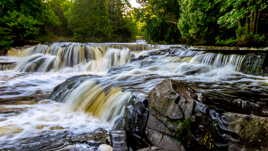
Here are some additional pro-tips that work for all hikes in the Upper Peninsula.
- Be prepared for all types of weather. The weather in the Upper Peninsula can change quickly, so be sure to bring layers of clothing and rain gear.
- Bring plenty of water and snacks. The trails have no facilities, so you’ll need to bring everything.
- Be aware of your surroundings. The trails can be slippery, and there are often rocks and roots to watch out for.
- Leave no trace. Pack out what you pack in and help keep the trails clean.
- Avoiding crowds. Arrive early in the morning or late in the evening when less people are on the trail.
- Wear sturdy and waterproof shoes. Terrain can be slippery and rocky, it is best to wear proper footwear to prevent any falls.
- Watch for wildlife. Keep a safe distance if you encounter any on the trails.
The Upper Peninsula of Michigan is a hidden gem for waterfall lovers. With over 300 waterfalls to explore, you’re sure to find the perfect spot to take a refreshing dip, snap some stunning photos, or relax and enjoy the beauty of nature. Are you ready to head up north for an epic summer road trip?


