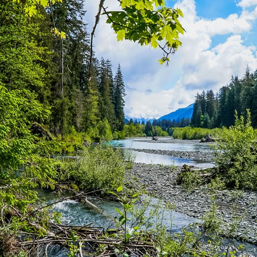
Hurricane Ridge
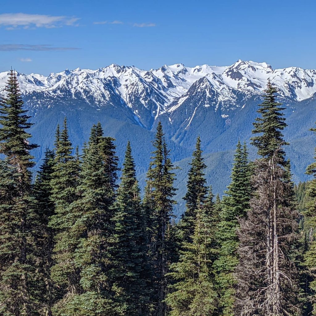
High above in the Olympic National Park is the beautiful trail of Hurricane Ridge. This easily accessible trail for all-level hikers will give people an awe-inspiring mountain view by just stepping out of their vehicles. The gorgeous scenery and easy to get to paths are why Hurricane Ridge is a popular destination choice for tourists. I highly recommend waking up early to beat the crowds, especially during peak season. The drive to the trailhead from Port Angeles is approximately 45 mins through the scenic mountain terrain. During peak season, you will be able to drive a mile and a half past the Visitors Center directly to the trailhead. However, if you’re planning to go during the springtime, you will have to park at the Visitor Center and hike an additional mile and a half out and back. The views are incredible as you venture up and over following the ridge-line. Be sure to keep an eye out for the wildlife. You may even spot the famous Olympic Marmot that resides on the mountainsides. The final push to the summit will give your legs an excellent workout, but with the switchbacks, it’s relatively a more leisurely hike. Once you reach the top, you will be surrounded by vast mountain ranges and lookout and see Port Angeles and Victoria, B.C. below. On a clear day, it’s possible to get a glimpse of Mt. Baker.
Pro-Tip: Drive past all the tempting overlooks while driving to the trailhead. You can hit these pull-offs on the way back down the mountain. Also, If you’re hiking during the springtime, make sure to pack your microspikes and poles; you will need them.
Distance- 3.4 miles if the road is open to the trailhead or 6.4 miles if traveling from the Visitor Center.
Route Type- Out and Back
Elevation Gain- 826 Feet
Difficulty- Moderate
Mount Storm King
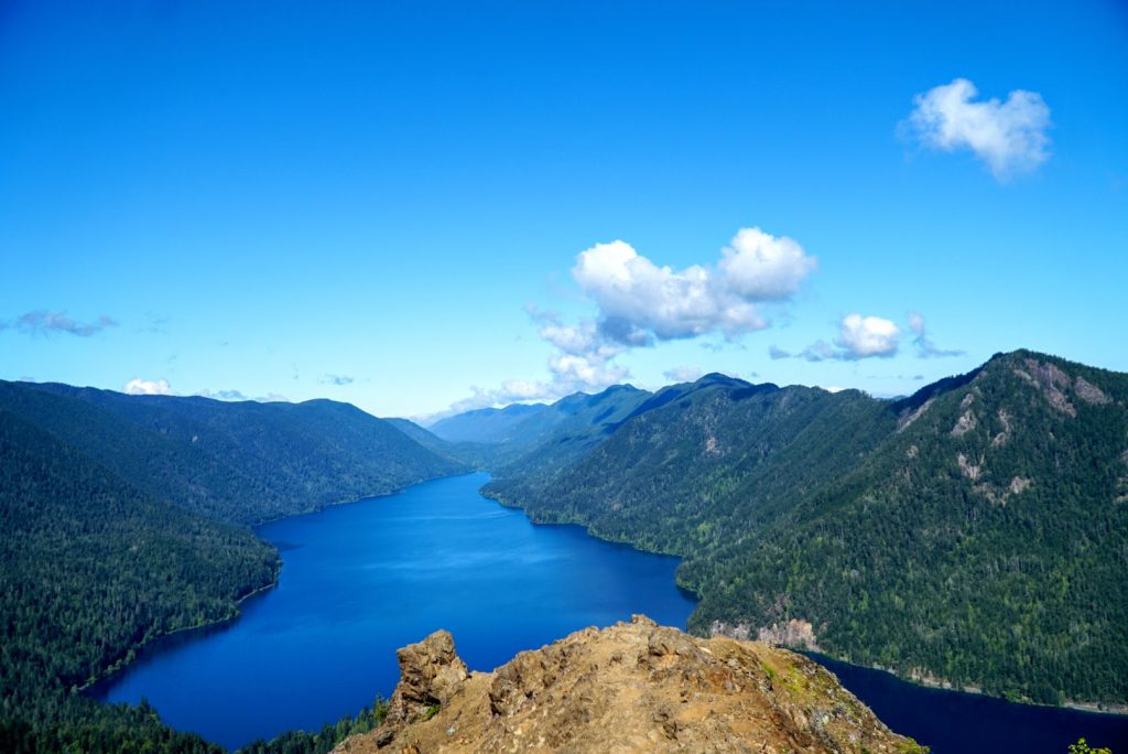
You know that feeling you get when you’ve been hiking 1000 ft per mile for the last two miles and finally reach the top? First, the awe-inspiring view hits you, and then the sense of accomplishment right after. Hiking Mount Storm King will give just that! The strenuous incline hike uphill can take a toll on your mind, body, and soul but don’t stop. Taking breaks as you climb up the steep path will help you reach the top, and your heart will thank you later. Just think of this hike as an outdoor High-Intensity Interval Training class! Who doesn’t like one of those?
Before reaching the sign of “End of Maintained Trail,” you will overlook the stunning Lake Crescent. For those who wish to turn around and go back, this is an excellent spot. However, if you want to take yourself to new levels and extend your limits, continue past the “End of Maintained Trail.” A quarter-mile away from the sign, you will begin to experience rock scrambles and steep drop-off points, which will continue till the rope section. The ropes are pretty worn down and sketchy-looking since they’re not maintained well. The ideal situation has only one person at a time on the rope section. For me, the rope section was pretty easy.
The in-between moments were another story. While grasping for the following rope sections, be on the lookout for loose sand and rock; this will become slippery. If you make it up the ropes, congrats, you’re almost there! Just one final obstacle stands between you and the best view of Lake Crescent. The last rock scramble can be pretty exhilarating due to the steepness on each side. You may even have thoughts on why you’re hiking this trail. However, reaching the top, all those thoughts will disappear. Taking in the surrounding view is entirely surreal. It may even make you feel a tad off-balance. The sense of accomplishment by making it to the top and being rewarded with the best view of the lake will become a cherished memory you can take with you. Venture to the edge if you’re feeling daring and get a fantastic photo op. After all, isn’t this part of why you would hike this trail? Although Mount Storm King may be tough, and trust me, you will feel it the next day; the payoff is worth every second. So the question now is, are you ready to take this mountain on?
Pro-Tip: Arrive early in the morning, so you don’t have to wait too long for the rope section. Pack light because taking a heavy backpack is not ideal for the final climb. Gloves may be beneficial when grabbing the ropes.
Distance- 5.3 miles
Route Type- Out and Back
Elevation Gain- 2,076 Feet
Difficulty- Hard
Marymere Falls
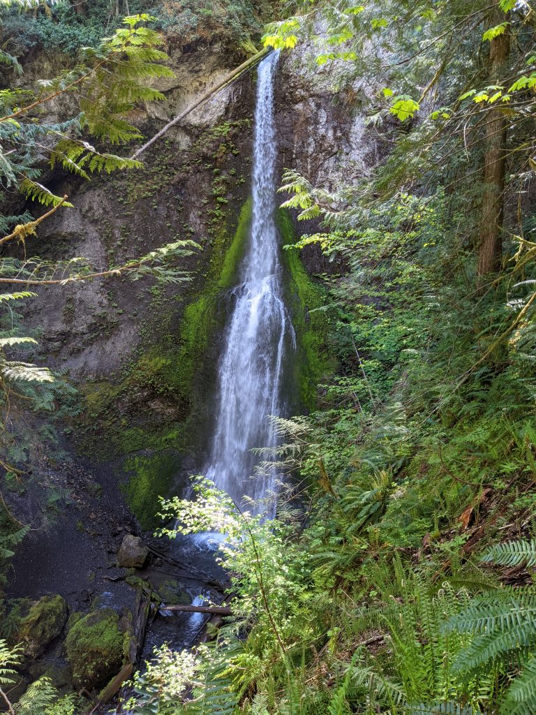
Marymere Falls is a nice easy hike to view a beautiful waterfall. This hike shares the same trailhead as Mount Storm King, which could be a tremendous additional hike after coming down from the mountain. Marymere Falls trail does have some stairs, and you will want to start the loop clockwise. It’s the best way to view the waterfall as you ascend the stairs. If you’re looking for a great photo op with the falls, wait till you’re at the top deck. Otherwise, your photos could potentially be misty-looking. The walk back through the wooded area is peaceful and has lots of visibility to see the forest floor. Make sure if you’re in this area to stop and visit Lake Crescent.
Pro-Tip: Wait to take your photos until you reach the top observation deck. The mist coming off the waterfall will cause images to become blurry.
Distance- 1.7 miles
Elevation Gain- 298 Feet
Difficulty- Easy
Sol Duc Falls
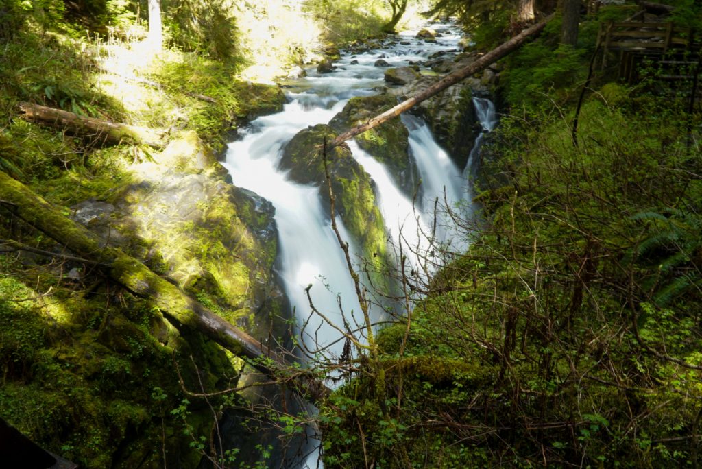
Straight out of a fairytale is the hike of the Sol Duc Falls. The Sol Duc Falls trail is an easily accessible 1.6-mile hike to the waterfall. During this hike, you will encounter a peaceful area filled with small waterfalls moving across mossy rock beds that make for a beautiful Pacific Northwest backdrop. As you continue walking through the lush rainforest, you will discover a backpacker’s shelter, and around this point will begin hearing the sounds of the rushing rapids. Walking across the wooden bridge, you can see the crushing waterfall pouring over the edge and plunging into the gorge below. Although this waterfall was truly remarkable, it made you think about what would happen if you accidentally fell in. Sol Duc Falls is one of my top favorite waterfalls that I have seen so far. The beauty and fairytale quality is nature’s masterpiece at work.
Pro-Tip: Visit this waterfall during shoulder seasons. You will be able to spend more time on the bridge getting those fantastic photos without other people around.
Distance- 1.6 miles
Route Type- Out and Back
Elevation Gain- 255 Feet
Difficulty- Easy
Hoh Rainforest River Trail
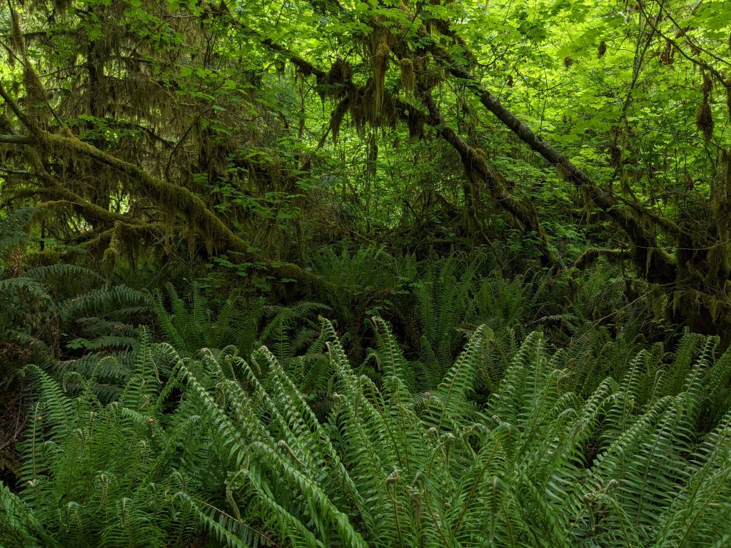
Take a walk in one of the four last remaining temperate Rainforests in the United States. The Hoh Rainforest has been awarded as a World Heritage site by UNESCO by being located in the Olympic National Park. Remaining unchanged for thousands of years, you will feel like you have immersed yourself into another world. Walking along the river trail, you will see moss cascading down ancient grove trees. Keep an eye out for wildlife through the forest floor. We were lucky enough to see elk grazing directly on the trail as we hiked this. We kept our distance and left the room before we continued. Hiking to Mineral Creek is about a 5.5-mile round trip out and back trail. Overall it’s relatively a flat and easy walk. Once you reach the falls, take the small path that leads up to it. You can capture some great photos up close and personal. Before heading out, make sure to stop by the Hall of Mosses. It’s a short less than a mile loop that takes you through ancient old-growth trees, moss-covered trees, and beautiful ferns.
Pro-Tip: Visit Hoh Rainforest early in the morning. During peak season, long waits getting in or finding parking spots can cause delays. Also, pack a light rain jacket in case of changes in the weather. After all, it is a Rainforest.
Distance- 5.5 miles
Route Type- Out and Back
Elevation Gain- 213 feet
Difficulty- Easy
Ruby Beach Trail
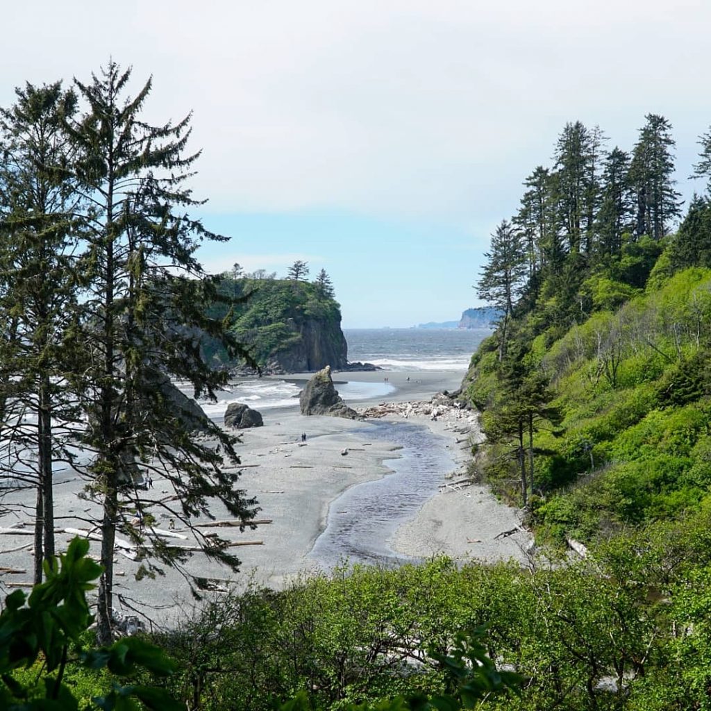
Ruby Beach is a lovely scenic beach trail that offers miles of exploring and discovering. Take a walk through the unique rock formations, hang out near driftwood sculptures, have a picnic amongst the sea stacks on the coastline, and be sure to venture over to Abbey Island to get a glimpse of the fascinating tide pools. Time your visit to Ruby Beach around low tide. During this time, you will be able to walk out and observe starfish, Anemones, Barnacles, and Mussels attached to the rocks. Although camping is not allowed on Ruby Beach, it’s a great day’s use. If you need to find a place to stay while visiting, there is a campground just south of Ruby Beach.
Pro-Tip: Check when low tide will be and arrive just a little before, so you can enjoy exploring the tide pools.
Distance- 1.0 miles
Elevation Gain- 49 Feet
Route Type- Out and Back
Difficulty- Easy
West Elwha River Trail
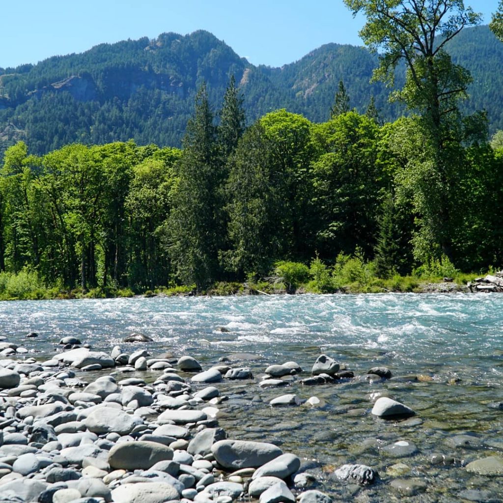
This trail is excellent for those who love to be in nature. The dense rainforest of beautiful greenery will take your breath away. Getting there, you will park in a residential area and hike about 1.5 miles to the entrance of the trail. This scenic hike takes you directly to the Elwha River. Although it’s a great downhill hike going out to the river, returning is a whole other experience. Once you reach the river, take the steep path to the riverbed. Relax on some driftwood and take in the view because going back, it’s all uphill.
Pro-Tip: Pack some bug spray with you. Due to the dense forest and old-growth fields, it can become “buggy.” Arrive during off times since there are not many spots to park along the road.
Distance- 6.1 mile
Route Type- Out and Back
Elevation Gain- 1,243 Feet
Difficulty- Moderate
Beaver Falls
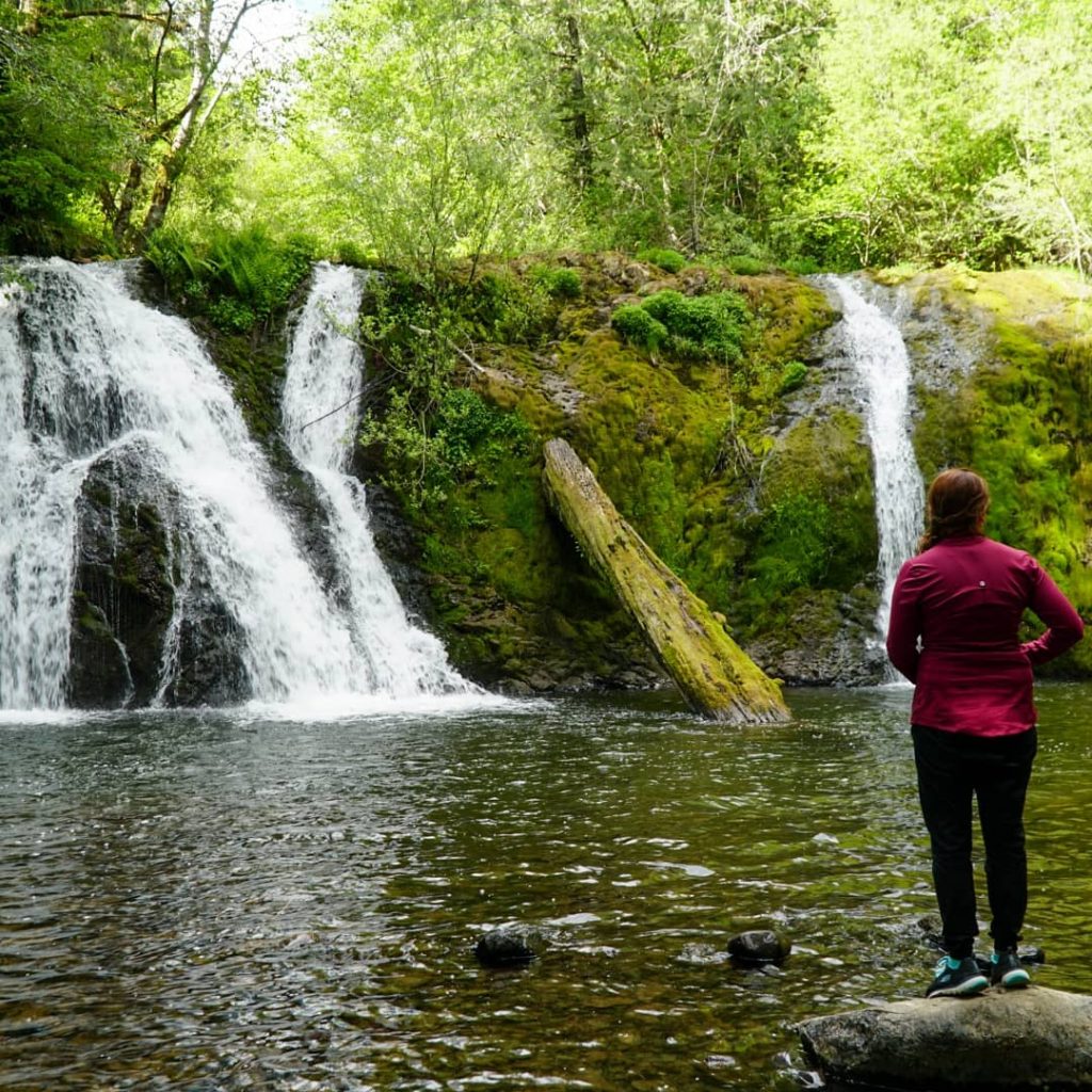
Beaver Falls is a mesmerizing waterfall that is secretly hiding under Route 113. The trailhead entrance is easy to miss when driving by, so be on the lookout when rounding the curve. Once you park, take the small trail that leads right next to the road. After descending a few feet down to the lower level, you will see the 28-foot tall waterfall expanding 70 feet wide over the bedrock. The beautiful waterfall is genuinely a peaceful spot to take it all in and be present. It’s definitely worth the quick stop, and the best part is it’s not heavily crowded.
Pro-Tip: Grab your camera and take a photo opportunity on the rocks leading out towards the waterfall.
Distance- 0.2 miles
Route Type- Out and Back
Elevation Gain- 16 Feet
Difficulty- Easy


